Prevent
Risk, drought, rain, weather, wind, NDVI and NDMI.
FireMonitor combines cameras, satellites, weather data and artificial intelligence so your operation can prevent, detect, respond to and analyse fires without switching tools.
Instead of isolated tools, FireMonitor connects territorial context, detection sources and operational intelligence in one place.
Risk, drought, rain, weather, wind, NDVI and NDMI.
AI cameras, heat spots and multi-source validation.
Location, threatened areas and spread forecast.
Burn scar, affected area, reports and recovery.
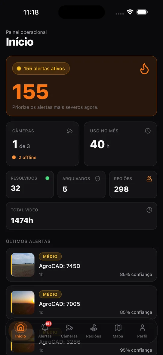
Monitored areas, cameras, alerts, satellite hot spots, weather conditions and incident history without switching tools.
FireMonitor turns weather, vegetation and environmental history into context so your team knows when and where attention must be higher.
Twenty-four hours a day, FireMonitor combines different sources to reduce blind spots and deliver a reliable reading of what is happening in the area.
Too many alerts wear the team down, and when the fire is real nobody runs any more. That is why the platform prefers to discard early: each stage only passes on what the previous one could not explain. The result: over 98% of what reaches the operator is relevant for analysis.
Computer vision sweeps the frame and sets apart what deserves a second look.
An AI model says what it is seeing: smoke, dust, fog, machinery.
The suspicion is re-examined with camera and region context.
Real smoke grows and drifts. Whatever does not behave like fire falls out here.
A second model confirms before anyone is called.
Nobody opens a dashboard at three in the morning. FireMonitor sends the alert on WhatsApp, direct or to the brigade group, and the conversation carries on there: whoever is in the field answers by text, audio or photo, and what they send becomes evidence on the alert.
The same number that sends the alert understands the reply. No option menus, no keywords.
South Tower camera • AgroCAD 1075 • 9.8 km
North Brigade dispatched. Send a photo or voice note when you reach the estimated point.
▶0:08
We reached the point. Smoke is visible in the north field.
Incident confirmedProtocol FM-2048 opened. Control center and stakeholders notified.
After confirmation, your team needs to understand direction, intensity and exposure. FireMonitor brings the critical variables into one operational timeline.
The history does not end when the fire is controlled. The platform organises evidence, vegetation indices and reports to support management and audit.
Continuous horizon monitoring and validation across multiple frames.
Heat spots tied to the monitored regions and properties.
Current environmental condition and evolution of risk factors.
Wind, rain, temperature, humidity and dry spells.
Advance scenarios and identification of potentially exposed areas.
Land registry, properties, fields and geographic context.
NDVI, NDMI, natural imagery and time series.
Full history of alerts, images, decisions and outcomes.
Real platform captures from a monitored operation: from the first signal to an auditable history.

Visual evidence, risk, wind, cameras, likely location and event progression.

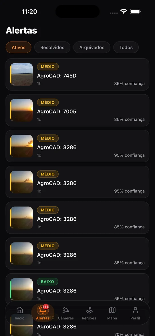
Status, severity, confidence and analysis stages in one operational queue.

Position, azimuth, field of view, range and latest frame for each device.

Polygons, hierarchy, risk and a visual timeline of the monitored area.

Vegetation fuel, humidity and dry spells monitored continuously.

Indicators, evidence and recommendations consolidated by period.
On the wall
Presentation mode takes the whole screen and stays on. Cameras rotate on their own, the map shows live coverage, and when a detection comes in the screen changes state and the alarm sounds. Built for the operations room, the gate house or the manager’s office.
In the team’s pocket
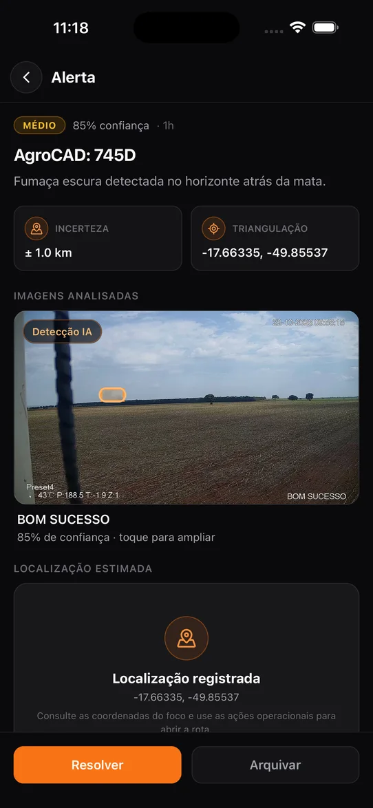
Whoever decides is rarely sitting at a computer. The app carries the same detection, with the photo and the box the AI drew, to the phone of whoever will respond.


Practical guides, company news and transparent comparisons to help your team choose and operate better.
How cameras, satellites, weather and AI connect to protect rural operations.
Read article →GUIDEWhat happens between a camera frame and a confirmed alert.
Read guide →PRODUCTMap, alerts, cameras, regions, prevention and reports.
View tutorial →COMPARISONSCompare FireMonitor, umgrauemeio, Pano AI, Dryad and OroraTech by approach.
Compare solutions →Every minute between ignition and the first alert is burned area. The platform exists to shorten that gap. Twenty-four hours a day, including the small hours when nobody is watching.
Not every operation starts with a trial. Tell us the size of the area, how many cameras exist today and what needs covering. We reply with a rollout plan and a proposal.
For 30 days, validate the detection, the environmental data, the alerts and the operational follow-up on a real area.